Horten

Explore coastal trails in Horten, with woodland, beaches, Viking heritage and Oslofjord views.
Horten offers marked coastal walking trails through deciduous woodland, past beaches and historic sites linked to the Viking Age and Norway's naval history. Choose a short circular walk around Karljohansvern, explore Løvøya or follow a longer coastal trail towards Åsgårdstrand. There are several ways to experience the Oslofjord close to the town.
Coastal woodland and beaches
Horten has approximately 40 kilometres of coastline, extending from the Holmestrand area in the north to the Tønsberg municipal boundary in the south. Along the trails, you will find woodland with mature oak and other deciduous trees, sheltered bays and beaches with sand or pebbles. Some paths follow the shoreline, while others run through woodland or along established pedestrian routes. In autumn, the woodland changes colour, making a shorter coastal walk particularly inviting.
Karljohansvern – a walk through naval history
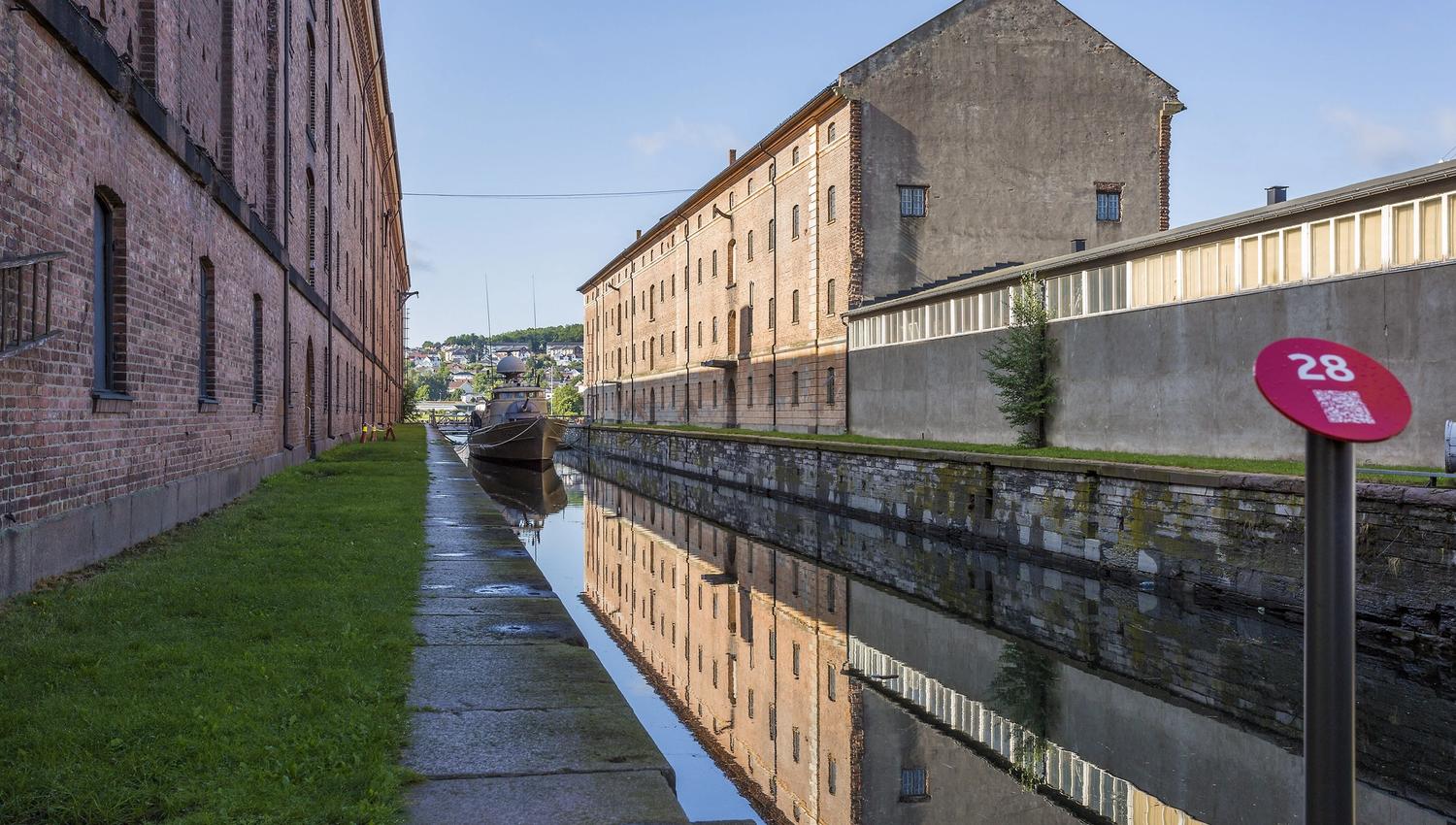
At Karljohansvern, the coastal paths pass through Horten's historic naval grounds, alongside old buildings, the canal and wooded areas near the sea. You can start near the Naval Museum and explore the paths beside the Horten Canal, through Hortensskogen and towards Møringa. Combine your walk with a visit to the Naval Museum or Preus Museum if their opening hours fit your plans. For a more specific route, see Karljohansvern Circular Walk.
Løvøya – a circular walk with fjord views
North of Horten, Løvøya has a coastal circular walk of approximately 4 kilometres. The route passes areas including Løvøy Chapel and Jesusbukta, with woodland and views across the Oslofjord. Some sections are uneven and rocky. Wear sturdy walking shoes and take care on wet roots and stones. See Løvøya Circular Walk for details about the route and parking.
From Horten through Borre to Åsgårdstrand
For a longer walk, follow the coastal trail from Falkensten through Horten and Borre towards Åsgårdstrand. The individual route description gives a distance of approximately 13 kilometres. Along the way, the trail passes Karljohansvern, Horten harbour, Rørestrand and the Borre burial mounds. Near the burial mounds, Midgard Viking Centre offers opportunities to explore local Viking history. Approaching Åsgårdstrand, the route continues through coastal woodland and past the area around Edvard Munch's former home before reaching Badeparken.
Find the full description under Coastal Trail Horten–Åsgårdstrand.
Choose a shorter coastal outing
You do not need to complete the entire route between Falkensten and Åsgårdstrand. Karljohansvern, Rørestrand and Borre all offer opportunities for shorter walks close to the water. At Rørestrand, you can stop by the beach. In Åsgårdstrand, Badeparken has a sandy beach and grassed areas near the guest harbour. Horten Municipality maintains several equipped bathing areas along the coast. Public toilets at municipal beaches generally operate during the summer season.
Choose the right trail for your visit
Horten's coastal trails generally have light-blue waymarks. Routes vary from broad walking paths to narrower natural trails with rocky or uneven surfaces. Some sections can also be cycled, but the shoreline walking paths do not necessarily follow the same route as National Cycle Route 1. Consult a dedicated cycle map if travelling by bicycle. For point-to-point walks, plan your return journey before setting out. Check the map, parking arrangements and terrain for your chosen section.
The trails can be explored at different times of year when weather and ground conditions allow. Follow local signs, take your litter home and respect the natural surroundings. For more inspiration, explore Hiking and Coastal Trails in Vestfold.
Plan your visit
Horten has several marked coastal trails between Falkensten, Karljohansvern, Borre and Åsgårdstrand. Choose a short circular walk or a longer route along the Oslofjord.
Distance and route options
The Løvøya circular walk is approximately 4 km. The individual Falkensten–Åsgårdstrand route is listed as approximately 13 km, while a broader coastal trail overview gives 17 km. The distance depends on the route chosen. Karljohansvern also has a separate circular walk. Check the map for your chosen trail.
Starting points and transport
Possible trailheads include Karljohansvern near the Naval Museum, Løvøya, Falkensten, Borre and Åsgårdstrand. Parking arrangements vary. Plan return transport for point-to-point walks and check current public transport services.
Terrain and accessibility
The coastal trails generally have light-blue waymarks. Some sections follow pedestrian paths and gravel tracks, while others cross rocky or uneven terrain with exposed roots. Wheelchair, pushchair and bicycle access has not been verified across the entire network. Check your specific route.
Good to know
Several beaches and picnic areas are found along the coast. Public toilets at selected municipal bathing areas are generally open from around 1 June to 30 August. Walking conditions depend on weather and season. Follow local protection and access rules, respect sensitive habitats and take your litter home.
Explore coastal trails and maps →
- Senderismo
Fuente: Visit Vestfold